HYDROGRAPHIC SURVEYS
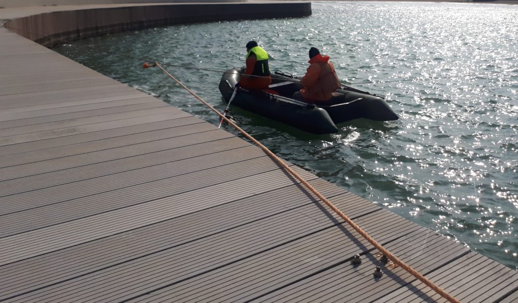
CASPIAN GEOMATICS company for bathymetry service (Sonar measurements) performs complex hydrographic surveys, Side Scan Sonar measurements. Depth measurements and geophysical surveys were carried out by us at various depths and shallow areas on the Caspian Sea. At the same time, we conduct extensive surveys on bathymetry service (Sonar measurements) in rivers and lakes. Bathymetric maps and models are created by us under numerous contracts, bottom relief models are developed, and Sonar surveys are carried out in the sea basin. As a result, profiles are created by acquiring high-resolution acoustic images. On the basis of Side Scan Sonar surveys, underwater object determination and mapping works are carried out. At the same time, we carry out survey works in facilities (objects) using single-beam and multi-beam methods. Using Remote Sensing, we carry out sea level monitoring, comparative analysis, determination of tides and changes, study of dynamics. There are different methods for bathymetry service.
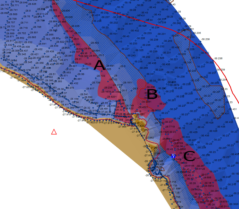
Bathymetry service
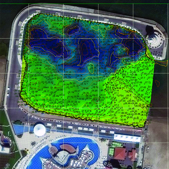
Methodologically, at the initial level of Bathymetry surveys (Sonar measurements), depth is considered based on the distance from the starboard and port. Then (secondly), correlation and interpretation are performed, and unknown underwater objects are detected and analyzed in the acoustic images. These objects include rock protrusions and communications, stony areas, various reinforced concrete piles, pipes of various diameters, and others, taking into account the relief. In the next level (thirdly), the detected object is thoroughly analyzed by us. Then (fourthly), the volume, dimensions, contours and coordinates of the objects in the image are selected and transferred to the map. In addition, during the conducted bathymetry and sonar surveys, geodetic provision is also carried out.. Finally, a bathymetric map is created.
Bathymetry and Sonar surveys serve to determine the structure of the relief in the areas where oil-gas, water and electricity (power) lines will be installed, the objects that hinder the installation, the technical condition of the pipes and their intersections, to study the relief of the place where the facility will be located, to determine the protrusions, to obtain an acoustic description of the bottom. In addition, Sonar surveys are widely used in the underwater analysis of the beach. Bathymetric and Sonar surveys also serve to survey the situation before dredging. If any underwater object is observed during sonar surveys, its size is calculated and interpreted. The dimensions of the determined underwater objects are noted and those objects are displayed with coordinates on the map. These dimensions include length, width and height parameters.
When gaps are detected in the lower part of the belt, initially (firstly), their length and height from the ground to the belt are indicated on the map. Solid rock protrusions are recorded with points, after interpretation, contours are indicated on the map. Broken and submerged parts of the platform are displayed on the map as a special note as a warning. As a result, in the case of waste on the bottom relief, a map of those objects is created. As a result, a report is presented to the Client. As a result, the methodology, equipment used, maps and models are reflected in the report. In addition, mosaic images are also presented.
HSE
Our staff consists of specialists trained on HSE and International Maritime Organization model courses. In addition, the staff have first aid, self-rescue techniques, fire fighting, and personal safety certificates.
In addition, the Client is provided with a preliminary risk assessment table, emergency situations plan and HSE policy.
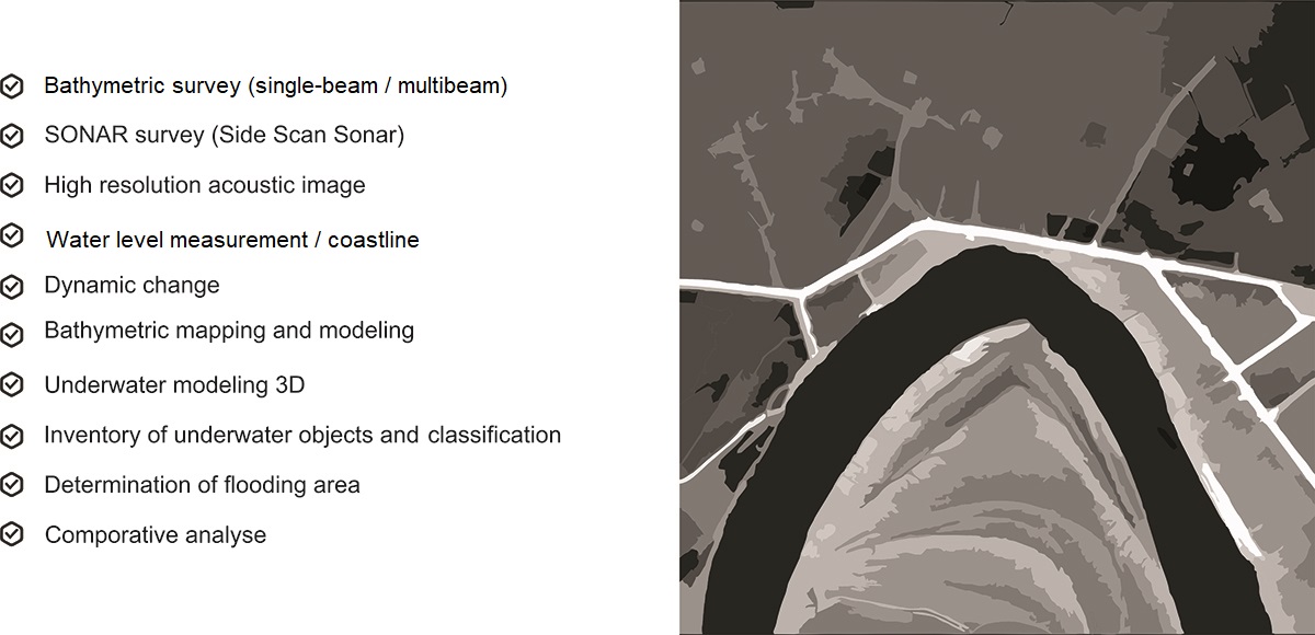
Bathymetry and Sonar surveys give the following results:
- bottom relief model and classification data of underwater objects
- profile graph, bathymetric map and volume calculation
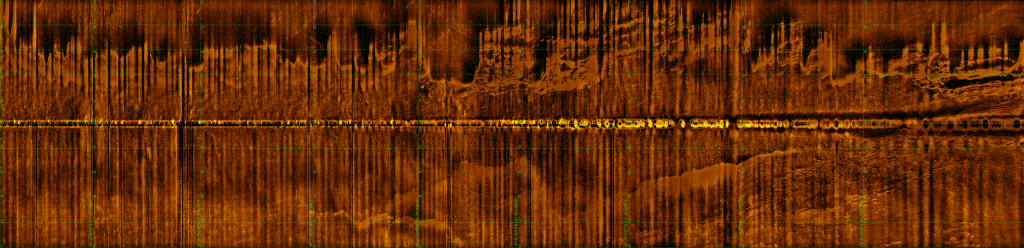
- Sonar-based acoustic images and mosaics
- Report on bathymetric surveys
- Geodetic provision for bathymetry studies
We -propose services on a modern technical basis:
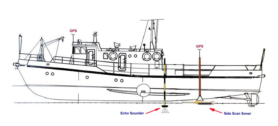
- bathymetry and side-scan sonar surveys, hydrographic mapping
- limnological studies (limnology)
- complex marine geodetic services
- creation of acoustic images, modeling
- prospecting works for the safe movement of the ship
- detection and classification of submerged underwater object, comparative analysis
- Coastal surveying
- discharge, level and other measurements
CASPIAN GEOMATICS company has all the capabilities to perform exploration works on the continental shelf, lakes and rivers, reservoirs.
SOME OF THE SIMILAR PROJECTS WE HAVE DONE
- Conducting engineering-geological and hydrogeological investigations and topographical surveys, performing soil laboratory investigations, technical inventory of canals within the framework of the Preparing Irrigation and Drainage System Development in Nakhchivan Autonomous Republic. Asian Development Bank, Nakhchivan Autonomous Republic Melioration and Water Farm OJSC, SOFRECO (January 2022/June 2022)
- Carrying out bathymetric surveys on Kura River (June 2022 / July 2022)
- Survey of the seabed in the project area (Lankaran) and investigation of active erosion processes in coastal zones (2020/August-September)
- Implementation of Bathymtric survey in the delta and on the basin of the Caspian sea (2020/May-June)
- Implementation os SONAR (Side Scan Sonar) and Bathymetric survey on the Caspian sea basin (2020/April)
- Performing Bathymetric investigation in southern coasts of the Caspian sea (2018/August)
- Performing Bathymetric survey in local areas on basin of the Caspian sea (2018/February-March)
- Performing Bathymetric survey in offshore territory of the Caspian sea (2018/February-March)
- Boyukshor lake remediation project Phase 2 – Engineering and Supervision (IQLIM LTD) (2018)
See also:
Remote Sensing
Geological & Geophysical surveys
GIS Solutions
Geodesy & Photogrammetry
Cartography