REMOTE SENSING
Absorption and reflection of radiation by ground surface objects are key factors in remote sensing (aerospace research / remote aerospace research). The same objects under different conditions can have different reflection and absorption properties. During the day, the Earth’s surface absorbs the Sun’s energy and turns it into heat. Soil and surface water are heated and their temperatures are reflected to the environment in the IR (infrared) range. At this time, the amount of energy and its intensity depends on the temperature of the radiated object. Objects on the Earth’s surface heat up in different ways and radiate heat in different ways. Such a feature of objects is important for remote sensing (remote aerospace research).
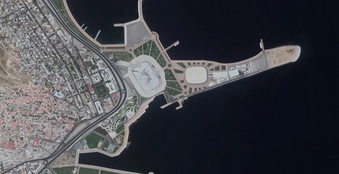
CASPIAN GEOMATICS company has rich experience in the field of thematic processing of Remote Sensing data and visual interpretation of various data, cartographic presentation. Our aerospace research includes the application of Remote Sensing techniques to lands of various purposes and infrastructure elements. At the same time, It includes the research of natural and artificial water bodies by aerospace methods, analysis and aerospace monitoring (chronology) of disasters, volume calculations of the amount of damage caused during natural disasters, determination of the dynamics of changes in objects and events, modeling, etc. includes.
We propose a number of specific services based on aerospace techniques:
- Determination of groundwater leaks from main water supply lines (water pipelines) by aerospace methods
- Detection and cartographic presentation of solid waste disposal and wastewater discharge into water bodies (rivers, canals, lakes, etc.)
- Determination and cartographic presentation of the location of underground and surface pipes (pipelines).
- Research of water bodies by non-contact methods
- Modeling and scientific justification of the dynamics of various objects and events with the application of aerospace methods
- Land use mapping based on aerospace methods
- Ecological monitoring of the environment (includes complex methods)
- Cartographic presentation of surface temperature distribution of land and water bodies
- Determining, modeling and cartographic presentation of processes in ecosystems in different periods or seasonally
Soil and vegetation cover, spectral properties of water, reflection, absorption and radiation abilities vary depending on the wavelength and physical-biological properties. During aerospace research, recognition of appearance, materials and substances, separation of contours is obtained. Researches should be taken in such spectral ranges that the differences in the reflection and absorption properties of soil, plant species, rocks, and water bodies in these ranges are as large as possible.
We propose other special services for Remote Sensing data:
- Detection, thematic mapping and modeling of anthropogenic impacts on various objects and events
- Creation of infrastructure maps
- Visual interpretation, modeling and cartographic representation of Remote Sensing data and data from other sources
- Creation maps of the optimal location of the exploration boreholes to be drilled based on satellite images
- Creation of digital orthophoto plans
- Creation and updating of the digital cartographic base
- Determining oil-contaminated areas and carrying out volume calculations
- Mapping of environmentally vulnerable areas
- Retrospective assessment of the ecological situation
- Determining and mapping of contaminated and unsuitable lands
- Determination of environmental damage during emergency situations
- Assessment of anthropogenic impacts
- Large-scale aerospace research in the fields of agriculture and forestry
- Land use and planning
Our services are available in the field of aerospace monitoring of water bodies and land cover. We establish our services on the basis of remote aerospace research and integration of modern methods and GIS technologies.
We approach the issues on a scientific basis, and this is the main criterion that distinguishes us from others. As a rule, the conclusion of each research results in the creation of a GIS, the established criteria are taken into account and mapped. The data and analysis results of the data collected on the object, as well as models and maps, are collected and systematized in the GIS environment.
SOME OF THE SIMILAR PROJECTS WE HAVE DONE
- Conducting engineering-geological and hydrogeological investigations and topographical surveys, performing soil laboratory investigations, technical inventory of canals within the framework of the Preparing Irrigation and Drainage System Development in Nakhchivan Autonomous Republic. Asian Development Bank, Nakhchivan Autonomous Republic Melioration and Water Farm OJSC, SOFRECO (January 2022/June 2022)
- Carrying out bathymetric surveys on Kura River (June 2022 / July 2022)
- Determining oil-contaminated areas within the framework of contract areas for Baku city using remote sensing methods (May – June 2022)
- Making digital map of Shusha city. State Tourisim Agency of the Republic of Azerbaijan (November 2020/2021- January)
- Creating Geographical Information System of Karabakh and Eastern Zangezur economic regions. State Tourisim Agency of the Republic of Azerbaijan (November 2020/2021- January)
- Creating Geographical Information System and making digital maps of the area of “Yukhari Bash” National Historical-Architectural Preserve included in UNESCO World Heritage List which is the historical centre of Sheki. State Tourisim Agency of the Republic of Azerbaijan (November-December, 2020)
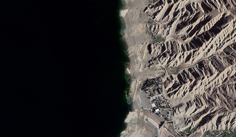
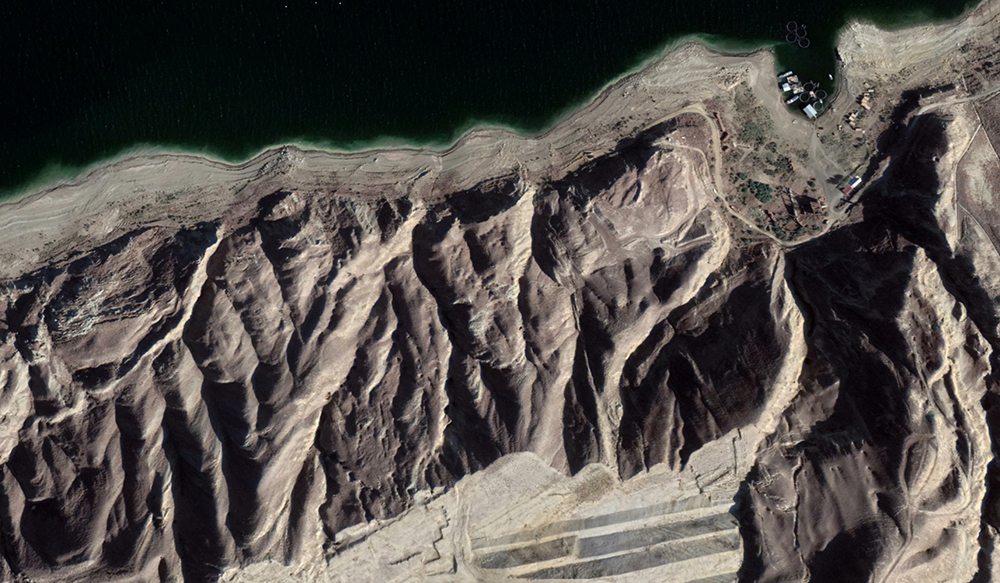
- Survey of the seabed in the project area (Lankaran) and investigation of active erosion processes in coastal zones (2020/August-September)
- Implementation of Bathymetric survey in the delta and on the basin of the Caspian sea (2020/May-June)
- Implementation os SONAR (Side Scan Sonar) and Bathymetric survey on the Caspian sea basin (2020/April)
- Making digital maps of some districts of Azerbaijan based on GIS on contract areas (2019/August)
- Implementation of Topographic works on 3200 hectare area of Yevlakh and Goranboy districts (2018/August)
- “Orthophoto mapping and creating topographic map of 7000 ha area of Saatli region” project (2018 January/February)
- Boyukshor lake remediation project Phase 2 – Engineering and Supervision (IQLIM LTD) (2018)
See also:
Geodesy & Photogrammetry
Geological & Geophysical surveys
GIS Solutions
Hydrographic survey
Cartography