Environmental services:
EIA – Environmental Impact Assessments
Environmental protection and restoration
Ecosystem and aerospace monitoring, GIS
Environmental research and control
Groundwater and drinking water monitoring
Natural resources management
Field expedition research
Pollution and disaster monitoring
Evaluation of sensitive areas and risks
Study of geolandscape structure
Ecogeographical study
Metoocean and sedimentation research
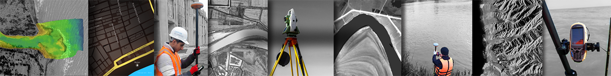
Geological and hydrogeological surveys
Geophysics, marine (bathymetry) & soil surveys
We offer engineering and consulting services for EIA in development projects. We are distinguished by our experience in GIS application, environmental modeling and map development.
Some maps compiled by us include:
- dynamic change, PAH and TPH maps;
- heavy and hazardous metals;
- silt layer, sediments (bottom sediments);
- classification and ecological maps;
- ecosystem & protection, flood risks;
- restoration-rehabilitation;
- sensitive areas and assessment;
- disasters and hazards, fauna;
- forest cover, atmospheric pollution;
- sanitary analysis;
- hydro-biological & ichthyological research;
- land use, infrastructure, climate maps.
CASPIAN GEOMATICS has signed numerous contracts in this direction.
CASPIAN GEOMATICS proposes monitoring and consulting services in addition to air, water and soil services. However, you can contact us about your project and take advantage of our consulting services. We offer engineering and consulting services on environmental impact assessment for new development projects in Azerbaijan as well as in other countries. At the same time, we are distinguished by our experience in the application of the geographic information system for various aspects of the environment, in environmental modeling and mapping.
Above all, it should be noted that the existing complex problems in this field require the application of modern methods. For instance, geographical information systems are the best method for environmental data analysis. However, it enables better monitoring and understanding of physical characteristics and factors impact a particular ecological situation, as well as various interrelation. As a result, after data analysis, geographic information systems allow planning and management of hazards and risks that will affect the environment.
During the environmental impact assessment, the team assesses the impact of the intended activity on the atmosphere, surface and groundwater, soil layer, flora-fauna, biological diversity, population health, and other directions.
Geomatics services
Geological & Geophysical survey services
Hydrography services
Consulting services
IT & System Integration