CASPIAN GEOMATICS company actively engages in exploration and prospecting, as well as conducting topography and geodetic surveys. The company completed topography and geodetic surveys in the following areas and signed numerous contracts:
- Agriculture and forestry
- Design of hydrotechnical facilities (reservoir, irrigation channel, pumping station, drainage, pressure pipeline)
- Geodetic and topographical survey on the port projects
- Hydrographic objects (marine, rivers and lakes, deltas, reservoirs)
- Engineering geodetic and topographic surveys of the offshore platforms, bathymetry
- Geodesy surveys (rocker arms, rotation stopper, identify angle of slope for extension block etc.)
- Roads and railways, transport
- DRONE (UAV) surveys, topographic stakeout
- Landscape design, facade survey, power lines
- Oil and gas industry, prospecting
- Raw material deposits, mining
- Construction of a TV tower
- Mountain coaster, exploration and prospecting
- topographical survey of cultural and historical monuments
- Construction and reconstruction of residential buildings
- Implementation of environmental projects
- Water supply and sewerage systems
- Design and coastal management
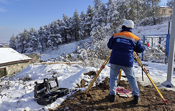
First of all, we should note that survey services include laser scanning surveying or aerial surveying (LIDAR). Firstly, we plan a flight using photogrammetric methods for topographic surveys. After that, we install benchmarks in the area to ensure geodetic accuracy. Thirdly, we measure their coordinates and elevations. As a result, we obtain high-resolution images for the purpose of topographic survey. Finally, we process the aerial photo, create the model, and regulate.