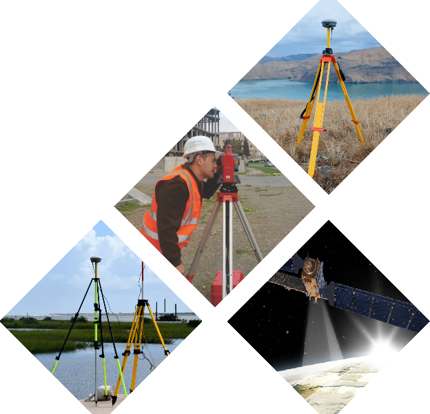
GEODESY & PHOTOGRAMMETRY
Geodesy (Marine geodesy, Bathymetric survey, topographical survey & side-scan sonar) and Photogrammetry services (DRONE surveys, LIDAR, ortophotos) are one of the main activities of CASPIAN GEOMATICS company. Moreover, our company, which has extensive experience in geodetic services, has signed numerous contracts for engineering studies.
Our main directions for geodesy services include:
- Marine geodesy
– Bathymetry surveys (single-beam and multi-beam)
– Geodetic solutions on offshore field
– Bathymetric modeling
– Geodetic provision of marine surveys
– Change detection based on geodetic survey
– Determination of the current situation of the stopper
– Marine surveys and geodetic provision
– Side Scan Sonar surveys - Geodetic surveys and technical inventory of hydrotechnical facilities (reservoir, canal and collector)
- Topographical surveys
- As-built drawings
- Creation and updating of topographic maps
- Preparation and installation of benchmarks and creation of geodetic monitoring network
- Geodetic survey of deformations of various buildings and facilities, constructions
- Geodetic provision for all construction objects
- Laser scanning surveys, LIDAR technology
- Drone surveys (Photogrammetry)
- Determination of underground communication lines
- Leveling for all classes
- Topography service for agricultural fields
Many sectors rely on accurate geodetic control (Floodplain mapping, Spatial management, Engineering and Construction, Geographical sciences, Agriculture). Topography is often studied using maps, which show the position of objects on the ground and their relationships to other elements. Preliminary assessment of the area is important for agricultural activities and infrastructure. Preliminary assessment is possible as a result of topographical survey. Moreover, the topography of an agricultural area can significantly impact the crops grown and the farming methods used. For example, areas with steep slopes may be more suited to terraced crops. Meanwhile, flatter areas are better for large-scale farming operations.
HSE
Generally, we strictly follow the rules of safety techniques in geodesy. Methodologically, HSE specialists assess the risks on the project area, and as a result, all the expected danger possibilities are reduced to the minimum level. As a result, safe execution of works is ensured. As a procedure, specialists first inspect the project area and prepare the necessary documents and present them to the Client.
review a number of projects that have been done
See also:
Remote sensing
Geological and geophysical services
GIS Solutions
Hydrography
Cartography