GIS SOLUTIONS
We have an extensive portfolio of geographical information systems services (GIS services) with numerous contracts both internationally and with the public and private sectors. Therefore, our portfolio includes the following areas:
- Agriculture and Forestry
- Oil and Gas Industry, Mining
- Urban Planning, Cadastre & Land Management
- Environment and Ecosystems
- Hydrogeology and Geology, Geophysics
- Exploration (engineering exploration)
- Marine and soil research
- Coastal management, erosion processes
- Emergency situations
- Hydrotechnical facilities, hydrographic objects
- Hydrological and ecological research
- Water supply and water resources
- Metoocean research
- Tourism, Ecosystems
- Transport (Automobiles & railways)
- Mapping, modeling, etc.
GIS SERVICES
- Geospatial database
- spatial data management
- geodatabase construction
- structural design
- spatial analysis and modeling
- geoinformation analysis of objects and events
- structural design
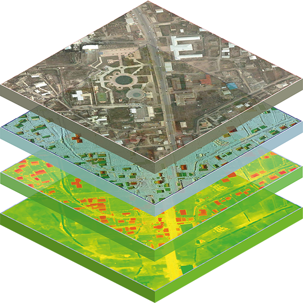
Above all, geographic information systems (GIS) services are widely used to model objects, understand trends, and investigate causes. Despite the wide scope of GIS applications, our experience provides special opportunities to build GIS on various topics and study the environment in depth, as well as conduct scientific research.
Above all, as it can be seen, the application areas of geographic information systems are wide. Topographic surveys were carried out tens of thousands of hectares of agricultural lands and geographic information systems of various purposes were created. In other words, from our side, the organization and planning of irrigation systems, the establishment of arable areas and the determination of suitable areas for cultivation, etc. has been resolved.
Agricultural experts always seek ways to achieve high yields without harming the soil and protect it from harmful substances. In short, geographic information systems play a crucial role in finding solutions to these problems. We offer a wide range of solutions to various agricultural issues using geographic information system services. Therefore, we digitize lands and combine statistical data with topographic-geodetic data to analyze the land more easily. Geographical information systems collect and process statistical data and samples to answer questions such as “what crops to plant?” and “where to plant them?” This allows for informed decision-making. The use of geographic information systems in agriculture is always relevant. Caspian Geomatics provides services such as spatial database services, spatial analysis, and modeling, for active involvement in agriculture.
Remote Sensing
Geological & Geophysical surveys
Geodesy & Photogrammetry
Hydrographic survey
Cartography