Geodetic survey and topography, geographical information systems, mapping, also bathymetry, photogrammetry (drone), remote sensing services are main activities of CASPIAN GEOMATICS company. Above all, while providing services to clients, we solve the issues on a scientific basis and using modern methods. In addition, company makes extensive use of Geographical Information Systems (GIS) to model environmental processes and various objects, as well as to understand tendencies. Our experience provides special opportunities to create GIS on various topics and to investigate the environment in detail.
GIS SERVICES
- Geospatial database
- spatial data management
- geodatabase
- structural design
- spatial analysis and modeling
- geoinformation analysis
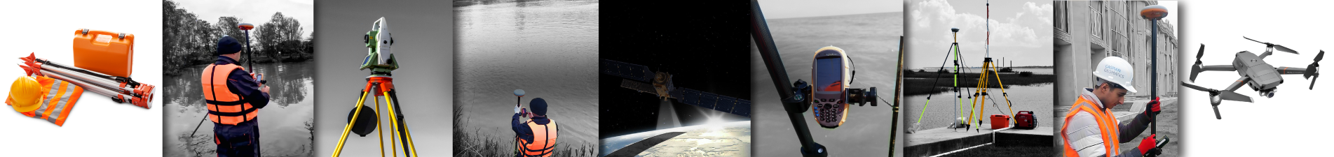
GEODETIC SERVICES
- Engineering geodesy & topographic surveys
- satellite & drone based photogrammetry service
- observation (control) & volume calculations
- marine geodesy (bathymetry), geodetic survey
- technical inventory of hydrotechnical facilities
- topographic stakeout of project, as-built survey
- engineering-prospecting, survey of deformation
- geodetic monitoring system, deformation study
- leveling and topographic mapping, GPS surveys
- laser scanning surveys and lidar technology
- topographic stakeout of project, as-built survey
CARTOGRAPHY SERVICES
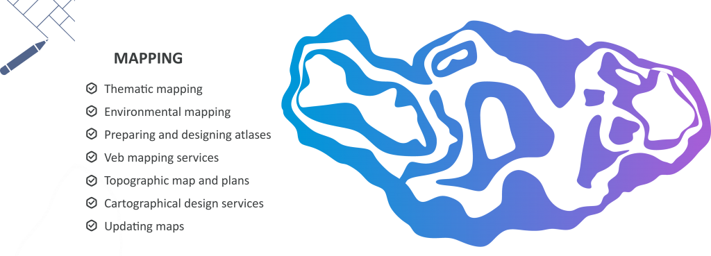
Cartography (Mapping) service includes drawing up of thematic & topographic maps, their updating, GIS and CAD service, creation and designing of atlases, web map and system integration. Above all, CASPIAN GEOMATICS is deeply involved in cartography and has rich experience in the design of maps and atlases. As a result, we have created numerous maps on various topics (for instance, thematic & environmental mapping). It should be noted that, during the creation of maps, we strictly follow the cartographic rules and are sensitive to the design criteria. However, during map design, it is necessary to have the ability to work with colors and to feel colors. In conclusion, the nature of colors and their harmony are important. Therefore, based on this, we treat each map in a special way, and these approaches add color to the maps.
REMOTE SENSING
- Classification maps on spectral analysis
- determination of spectral characteristics
- change detection and mapping
- aerospace monitoring, pixel evaluation
- assessment of anthropogenic impacts
- environmental assessment etc.
In addition, the company has the ability to apply remote aerospace research methods in different fields. In other words, these areas mainly include coastal management, agriculture, environment, urban planning & mining. We draw up structure and forecast, alteration and classification, as well as environmental maps and prepare reports based on the wide use of remote aerospace methods for water resources, hydrology & ecology, ecogeography, geological study.
PHOTOGRAMMETRY SERVICES
- creation of high-resolution orthophotoplans
- LIDAR / point cloud / ortophotomap
- ortho-rectification, DEM/DTM
- drone surveys and topographic mapping
- photogrammetry-based volume calculation
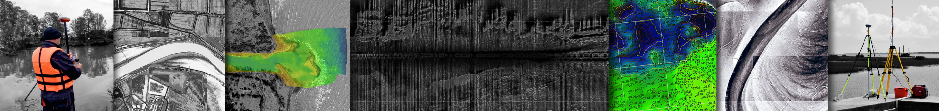
HYDROGRAPHIC SURVEY SERVICES
- Bathymetric surveys (bathymetry), mapping
- limnological studies (limnology)
- side-scan sonar, bottom sediments
- high-resolution acoustic images
- detection (underwater)
- dynamic change, sedimentation, coastal survey
review a number of projects that have been done
Environmental services
Geological & Geophysical survey services
Hydrography services
Consulting services
IT & System Integration