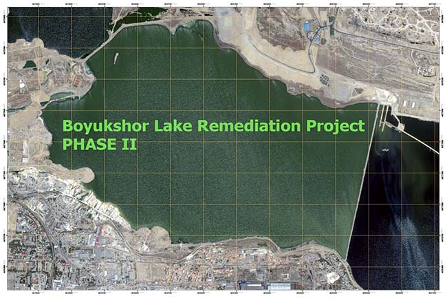
ORTHOPHOTO & TOPOGRAPHIC MAPPING OF
Orthophoto maps were created based on satellite data in 7000 ha , topographic surveying was carried out based
Orthophoto maps were created based on satellite data in 7000 ha , topographic surveying was carried out based
Environmental mapping / Geodetic engineering / Boyukshor lake / Geomatics Rehabilitation Phases: I- East part of the lake