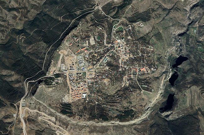
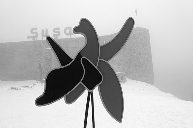
SEWERAGE AND WATER SUPPLY PROJECT (SHUSHA / DASHALTI)
Wastewater treatment plants / Shusha wastewater treatment plants complex / Sampling – 687m / Diameter – 132mm / Geodetic survey…
GEODETIC SURVEYS ON AYRICHAY RESERVOIR AND IRRIGATION CANALS
SCADA system, Geodetic surveying, DRONE, GIS & topographic mapping, engineering, DEM / DTM, technical inventory of irrigation canals. In order…
ENGINEERING SURVEYS IN THE GARADAGH & SHAMKIR DISTRICTS
Prospecting and engineering works at the Norm cement plant and raw material areas included carrying out topographical & geodetic surveys,…
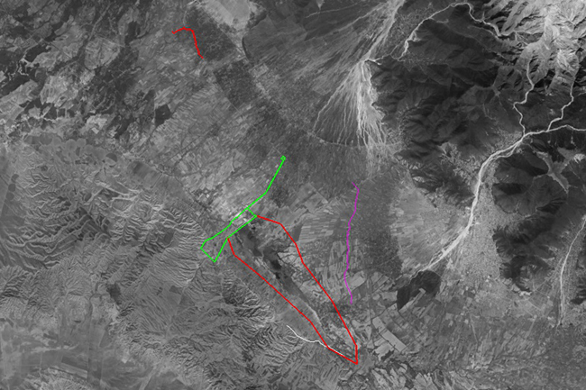
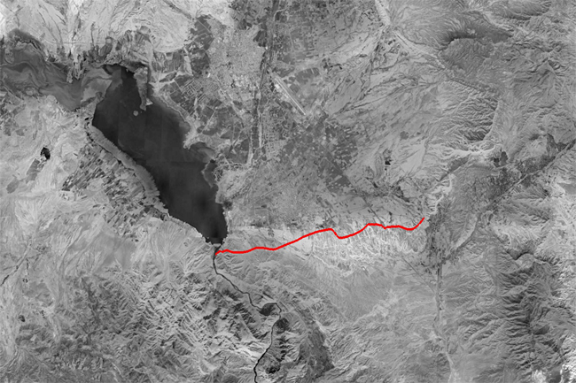
ENGINEERING & HYDROLOGICAL SURVEY ON THE BANANIYAR CANAL
Hydrological survey, GIS, SCADA consulting, DEM and DTM, mapping, geology, exploration & drilling, geodetic surveying. A contract was signed with…
DESIGN OF PIPELINE & PUMPING STATIONS FEED FROM ARAZ RIVER
Hydrogeology and Geology, Topographic surveys, soil sampling, drilling, soil laboratory. The surveys for the design aimed to investigate the surface…
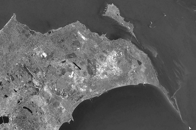
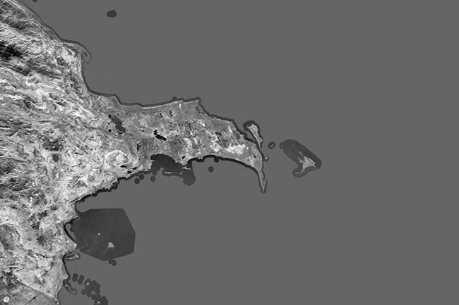
IMPACT OF LEVEL FLUCTUATIONS ON LANDSCAPE ECOLOGY CONDITION
Sea level fluctuations, Wind regime and currents, topographic and bathymetric surveys, mapping "Impact of Caspian Sea level fluctuations on the…
INVESTIGATING SOIL AMELIORATION IN JABRAYIL DISTRICT
Thematic mapping, soil laboratory, sampling, soil amelioration investigating, salinity, GIS and soil analyse. The team signed a contract to conduct…
ASSESSING CHANGES IN NATURAL OBJECTS ON GUBADLI DISTRICT
Based on satellite images and GIS technology, determining the spreading areas of wildfires and areas with fire danger, studying the…
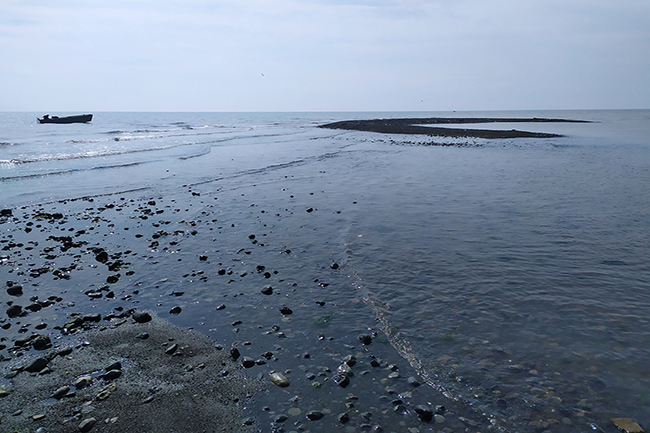
BATHYMETRIC SURVEYS ON THE “AYPARA” PROJECT
Bathymetry survey, based on hydrographic echo sounder, bathymetry map, 3D, GIS. The Company signed a contract to conduct bathymetry &…

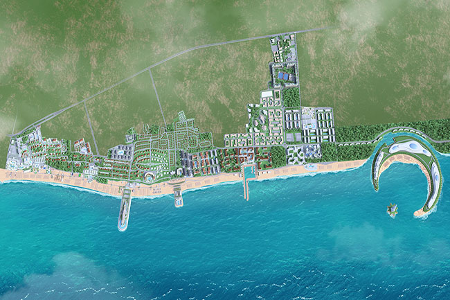
BATHYMETRIC SURVEYS ON THE “CASPIAN DREAM LINER” PROJECT
Caspian Dream Liner Sea Breeze Resort project, CAD, 3D modeling, mapping, aquatoria, GIS, GPS navigation, bathymetry & topography survey. To…
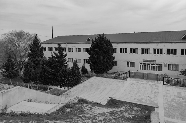
RECONSTRUCTION PROJECT OF HOKMELI SCHOOL (ENGINEERING)
To carry out engineering geological and soil laboratory research related to the reconstruction of the high school in Hokmeli settlement.…
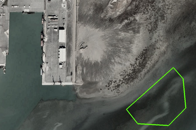
BATHYMETRIC SURVEYS “NEW BAKU INTERNATIONAL SEA TRADE PORT”
Bathymetry & topography survey, remote sensing, geodetic surveys A contract was signed for the purpose of carrying out bathymetry surveys…
FIELD SURVEYS IN NAKHCHIVAN AUTONOMOUS REPUBLIC (ADB)
Technical inventory (77 km) / Topographic surveys / GIS / Engineering Geological surveys / Mapping / Hydrogeological surveys / Soil …
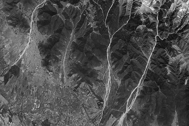
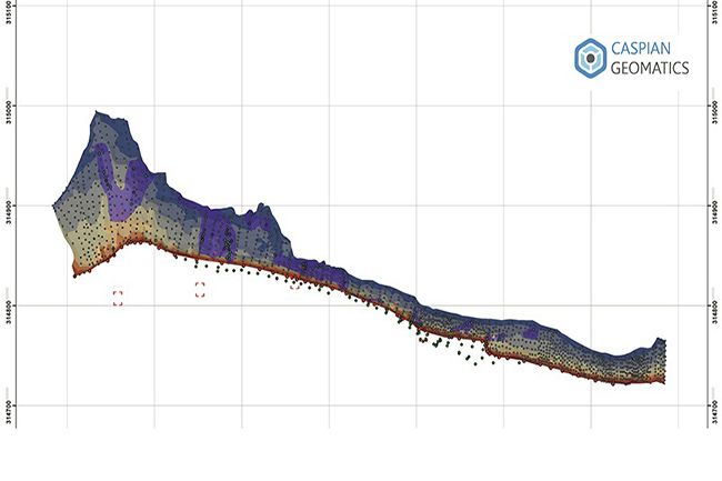
ASSESSMENT OF RIVER BEDS ON FLOOD HAZARDOUS RIVERS
A contract was signed with Caspian Geomatics on March 02, 2022 for the purpose of assessment of river bed processes…
STUDY OF MODERN CHANGES IN WATER RESOURCES PHASE 1
A bilateral agreement was concluded for the purpose of complex study of water resources and reconstruction of water farm infrastructure…
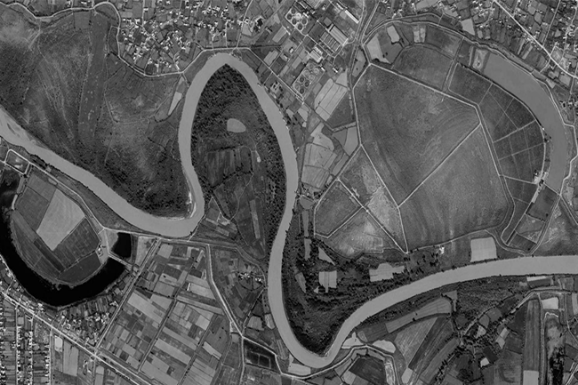
CARRYING OUT BATHYMETRIC SURVEYS ON KURA RIVER
Surveyors carried out bathymetry and topography surveys on the Kura River between Hashimkhanli & Akhtachi Mughan village of Sabirabad district…
NEW GIS OF KARABAKH & EASTERN ZANGAZUR ECONOMIC REGIONS
To assess the condition of cultural and historical monuments in our liberated territories, we need to create a GIS. (For…
DETERMINATION (REMOTE SENSING) OF OIL CONTAMINATED AREAS
Based on the signed bilateral agreement, team of the company determined the oil-contaminated areas of Baku city using aerospace methods…
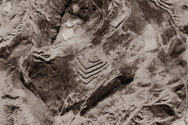
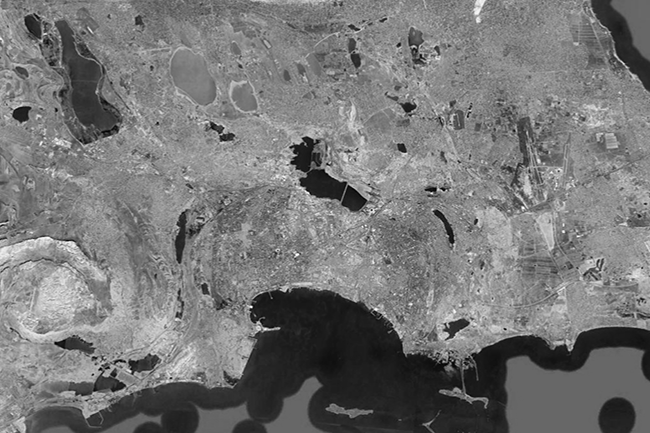
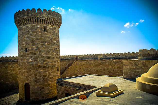
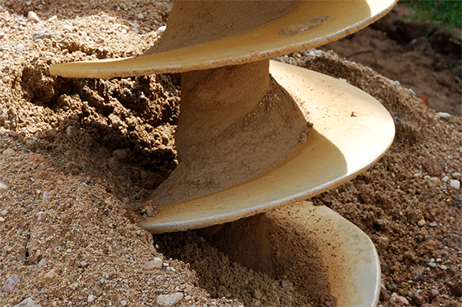
GEOLOGICAL AND GEOPHYSICAL SURVEYS IN SHUSHA CITY
Wireline drilling (240 m) / Multichannel Analysis of Surface Waves (MASW) / Geophysical survey (396 m) / Topography (4.2 ha) …
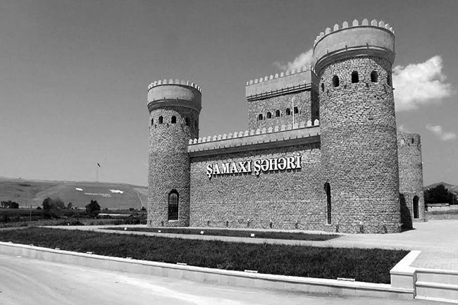
Hydrogeological & geological surveys in Shamakhi district
Sampling 37 / Geological drilling / Soil laboratory / Hydrogeological survey / GIS mapping Caspian Geomatics LLC conducted geology and…
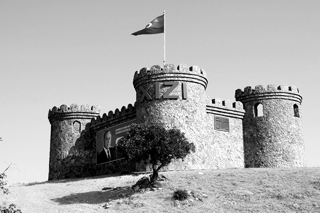
Hydrogeological & geophysical surveys in Khizi district
Caspian Geomatics conducted hydrogeological & geophysical surveys in the Khizi. To improve the water supply, we investigated and explored the…
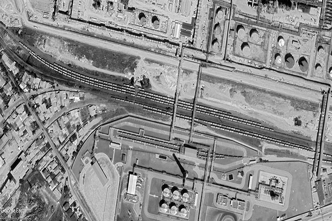
Topographic survey of the railways (Baku city)
The total volume of topographic survey was 14746.9 m. On the basis of the bilateral contract, engineering-topographical surveys were carried…
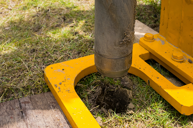
Surveying & Prospecting on the Shikhov Skypark Project
Wireline drilling – 1220 meters, Seismic -1.0 km, SPT, Pressuremeter test, Inclinometer test – 120 meters. A contract was signed…
The GIS of the “Yukhari Bash” Reserve is being created (Shaki)
The authorities have signed a bilateral agreement to create a geographical information system (GIS). The team also compiled thematic maps…
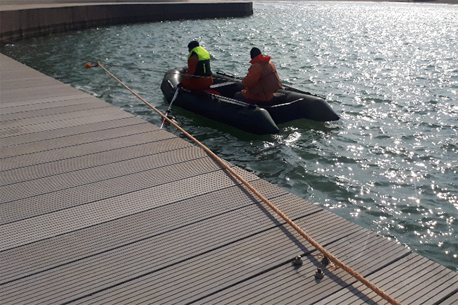
HYDROGRAPHIC SURVEYING AND EXOGENOUS STUDY, COASTAL ZONE
Hydrographic surveying were conducted in 3 ha, study of exogenous processes was carried out along 300 meters of coastline. There…
HYDROGEOLOGICAL INVESTIGATION IN TURKAN SETTLEMENT
In order to improve the water supply of Turkan settlement of Khazar district, there is a need to conduct hydrogeological…
HYDROGEOLOGICAL INVESTIGATION IN THE KHAZAR DISTRICT
In order to improve the water supply of Gala settlement of Khazar district, there is a need to conduct hydrogeological…
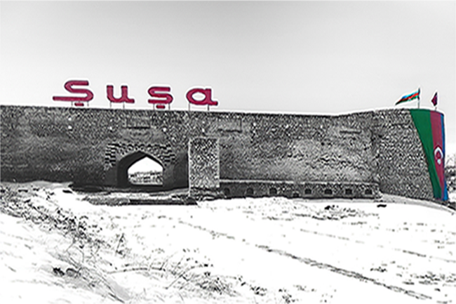
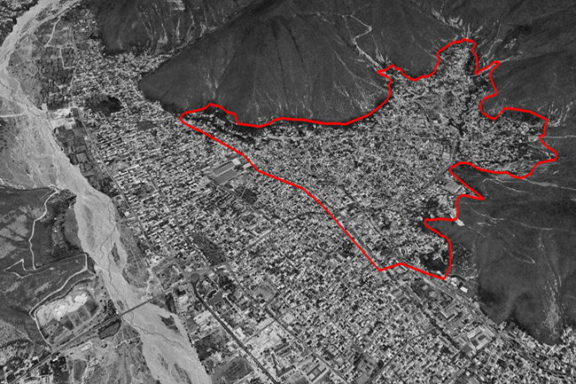
A NEW GIS MAP OF SHUSHA CITY HAS BEEN COMPILED
GIS mapping of Shusha city. Our specialists compiled the GIS map of Shusha city. At the same time, after GIS…
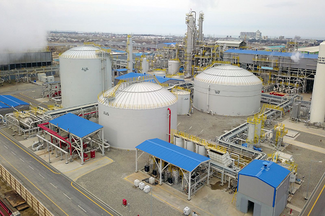
GEODETIC & TOPOGRAPHIC SURVEYS (SOCAR CARBAMIDE PLANT)
CASPIAN GEOMATICS LLC signed a contract for engineering-geodetic and topographic surveys. The team carried out the works at the SOCAR…
GEOLOGICAL & GEOPHYSICAL SURVEYS ON “ALAT CITY” PROJECT
The scope of geological drilling was 430 meters, seismic surveys were conducted on two profiles (length of profiles 120 m).…
BATHYMETRIC SURVEY IN THE DELTA AND THE CASPIAN SEA
Bathymetric surveys were carried out in a 16 ha area with a single-beam hydrographic echo sounder (Caspian Sea). The project…
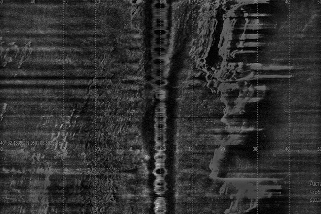
BATHYMETRY & SIDE SCAN SONAR SURVEYS IN THE CASPIAN SEA
Bathymetry & Side Scan Sonar Surveys, MBES - multibeam echo sounder, Sonar Imaging & bathymetric mapping, bottom relief. Sonar &…

GIS MAPPING OF CONTRACT AREAS (AZERBAIJAN REPUBLIC)
Being involved in oil sector, our client is one of the company who has a wide range of contract fields…
ENGINEERING GEOLOGICAL INVESTIGATIONS FOR RESERVOIR
The team conducted engineering geological investigations to design the reservoir, and they drilled a total of 168 m. The parties…
GIS SERVICES ON WATER SUPPLY, SEWERAGE & RAINWATER SYSTEMS
GIS services for the Master Plan of the “Absheron Peninsula Drinking Water Supply, Sewerage and Rainwater Systems” project were performed…
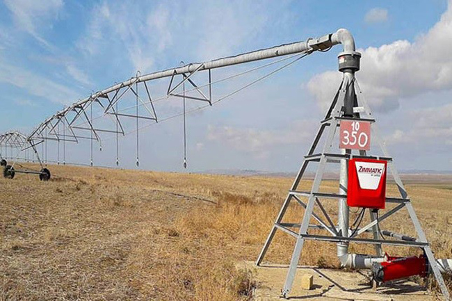
TOPOGRAPHICAL SURVEYS OF AGRICULTURAL AREAS (SHAMKIR)
The Company signed a contract to conduct topographic surveys and geoinformation analyses on an area of 8000 ha. This area…
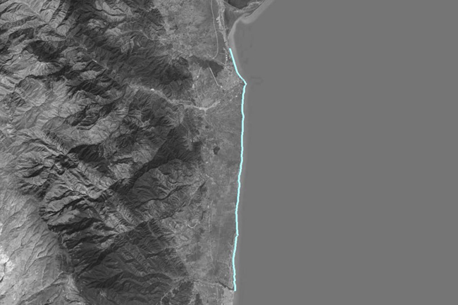
BATHYMETRIC SURVEYS OF THE SOUTHERN COASTS (CASPIAN SEA)
Parties signed bilateral contracts for performing seabed mapping (seafloor mapping). Along the southern coasts of the Caspian Sea is where…
BATHYMETRIC SURVEYS / “DALGA BEACH” PROJECT
Post-Dredge Surveys / Dredging / Seafloor mapping / Marine construction / Hydrographic services / GIS A bilateral agreement was signed…
BATHYMETRIC SURVEYS / “DALGA LITE, MARDAKAN” PROJECT
Underwater Mapping / Dredging / Seabed mapping / Bottom relief / Seafloor mapping. A bilateral agreement was signed to conduct…
TOPOGRAPHIC SURVEYS OF AGRICULTURAL AREAS
Topographic surveys were carried out in 3200 ha, topographic map was compiled on the scale of 1: 5000. Initial evaluation…
ORTHOPHOTO & TOPOGRAPHIC MAPPING OF SAATLI REGION
Orthophoto maps were created based on satellite data in 7000 ha , topographic surveying was carried out based on DRONE…
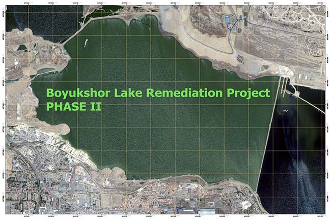
Boyukshor Lake Remediation Project Phase 2
Environmental mapping / Geodetic engineering / Boyukshor lake / Geomatics Rehabilitation Phases: I- East part of the lake II- West…